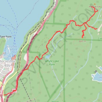
West Knob and Whyte Lake
Hike to West Knob and Whyte Lake via Baden Powel Trail, Whyte Lake Trail, Rock Pile, Donut Rock Trail and West Knob Access in the Whyte Lake Park and the Cypress Provincial Park. #Hike #Mountain #Lake #Nature #Forest #Park
- Distance : 11,5 Km
- Dénivelé positif : 716 m
- Altitude maximum : 720 m
- Dénivelé négatif : 712 m
- Altitude minimum : 73 m
- Temps en mouvement : 3 h 53 m
- Vitesse en mouvement : 2,9 Km/h
- Vitesse maximum : 14,2 Km/h
- Temps total : 5 h 15 m
- Vitesse globale : 2,2 Km/h
- Date : 20.03.2024
Carte interactive
Profil de la trace GPS
À propos de cette trace GPS
Nom : Trace GPS West Knob and Whyte Lake, itinéraire, parcours
Coordonnées : 49.36688 -123.27518 49.38781 -123.24092
Autres traces GPS
Cliquez sur une trace GPS pour visualiser son itinéraire, ses statistiques et son profil.