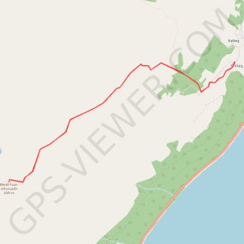
Meall Fuar-mhonaidh, near Drumnadrochit
GPX file from Walkhighlands; file is copyright Walkhighlands and must not be publicly shared on other websites. Do not remove this notice.
- Distance : 9,3 Km
- Dénivelé positif : 504 m
- Altitude maximum : 692 m
- Dénivelé négatif : 504 m
- Altitude minimum : 188 m
Carte interactive
Profil de la trace GPS
À propos de cette trace GPS
Nom : Trace GPS Meall Fuar-mhonaidh, near Drumnadrochit, itinéraire, parcours
Départ : Bunloit Road, Tornabrack, Lewiston, Highland, Écosse, IV63 6XF, Royaume-Uni (57.28016 -4.50471)
Arrivée : Bunloit Road, Tornabrack, Lewiston, Highland, Écosse, IV63 6XF, Royaume-Uni (57.28013 -4.50461)
Coordonnées : 57.26421 -4.56000 57.28016 -4.50461